 Hikes
Hikes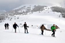 Mountain leaders
 Around us
")

")
Circuit du chalet Stahlberg


About the walk
path
Start :
Parking at réservoir
Altitude difference :
296 m
Length :
2,12 Km
Useful information
hiking path
IGN walking map needed :
3620ET
Marking :
Difficulté : intermédiaire


They are intended for hikers and accessible only on foot. Free access all year and free!
This cottage is on the heights of Wegscheid. Inside you will find a stove to warm you (to use and extinguish before departure). Also at your disposal a barbecue.
Hiking shoes are recommended.