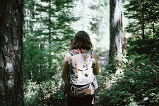
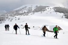
Hundsruck pass  

route Joffre
68290 Bourbach-le-Haut
Location

Nearest train station :
6,5 km - Bitschwiller lès Thann

Catering on spot : Restaurant

The Hundsruck pass (748 meters high), is a pass which links the Thur valley to the Doller valley through the Joffre route. This road (15 km length) was open during the 1st World War to allow french troops to reach both valleys and supply the the battlefront of the Hartmannswillerkopf - Vieil-Armand. At the top of the pass, a war memorial is a tribute to men who fought there and freed Bourbach-le-Haut. And this spot marks the start of many hike towards the Thannerhubel or the Rossberg mountains.

Photo gallery


©Guy Wurth
© Office de Tourisme de Thann-Cernay

useful information


  Mountain

Rates


  Restauration sur le parcours

Besoin d'informations ?
Retrouvez nos brochures !

Proposer
Une manifestation

Une question ?
Contactez-nous !

Besoin d'informations ?
Retrouvez nos brochures !

Retrouvez-nous aussi sur

Une question ?
Contactez-nous !

Maps & brochures ?
Free download !

Follow us on

A question ?
Contact us !

Tourist office in Saint Amarin


81, rue Charles de Gaulle - 68550 SAINT-AMARIN
Monday to Saturday from 10 to 12 am and from 3 to 5 pm - On Sundays and bank holidays from 10 to 12 am.

En poursuivant votre navigation sur ce site vous acceptez l'utilisation des cookies.